
Thank you for supporting this site ❤️
Make a donation
Make a donation
Gathundia topographic map
Click on the map to display elevation.
Thank you for supporting this site ❤️
Make a donation
Make a donation
About this map
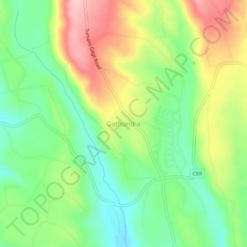
Name: Gathundia topographic map, elevation, terrain.
Location: Gathundia, Ol Kalou, Nyandarua, Kenya (-0.27000 36.26330 -0.23000 36.30330)
Average elevation: 2,579 m
Minimum elevation: 2,494 m
Maximum elevation: 2,700 m
Thank you for supporting this site ❤️
Make a donation
Make a donation