
Thank you for supporting this site ❤️
Make a donation
Make a donation
Four Forks topographic map
Click on the map to display elevation.
Thank you for supporting this site ❤️
Make a donation
Make a donation
About this map
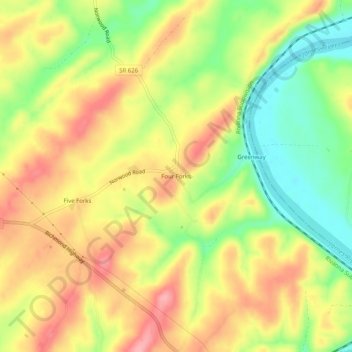
Name: Four Forks topographic map, elevation, terrain.
Location: Four Forks, Nelson County, Virginia, 24533, United States (37.56209 -78.86446 37.60209 -78.82446)
Average elevation: 168 m
Minimum elevation: 108 m
Maximum elevation: 220 m
Thank you for supporting this site ❤️
Make a donation
Make a donation
Other topographic maps
Click on a map to view its topography, its elevation and its terrain.
Thank you for supporting this site ❤️
Make a donation
Make a donation
Thank you for supporting this site ❤️
Make a donation
Make a donation