
Thank you for supporting this site ❤️
Make a donation
Make a donation
Hatupangan topographic map
Click on the map to display elevation.
Thank you for supporting this site ❤️
Make a donation
Make a donation
About this map
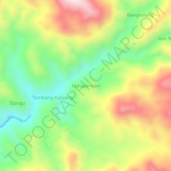
Name: Hatupangan topographic map, elevation, terrain.
Location: Hatupangan, Mandailing Natal, North Sumatra, Sumatra, Indonesia (0.70152 99.39476 0.74152 99.43476)
Average elevation: 522 m
Minimum elevation: 244 m
Maximum elevation: 869 m
Thank you for supporting this site ❤️
Make a donation
Make a donation
Other topographic maps
Click on a map to view its topography, its elevation and its terrain.