
Thank you for supporting this site ❤️
Make a donation
Make a donation
Five Points topographic map
Click on the map to display elevation.
Thank you for supporting this site ❤️
Make a donation
Make a donation
About this map
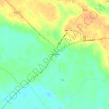
Name: Five Points topographic map, elevation, terrain.
Location: Five Points, Tattnall County, Georgia, United States (31.90215 -82.05401 31.94215 -82.01401)
Average elevation: 33 m
Minimum elevation: 15 m
Maximum elevation: 55 m
Thank you for supporting this site ❤️
Make a donation
Make a donation
Other topographic maps
Click on a map to view its topography, its elevation and its terrain.