
Thank you for supporting this site ❤️
Make a donation
Make a donation
Evans topographic map
Click on the map to display elevation.
Thank you for supporting this site ❤️
Make a donation
Make a donation
About this map
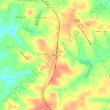
Name: Evans topographic map, elevation, terrain.
Location: Evans, Chester County, South Carolina, 29706, United States (34.64986 -81.21064 34.68986 -81.17064)
Average elevation: 174 m
Minimum elevation: 141 m
Maximum elevation: 201 m
Thank you for supporting this site ❤️
Make a donation
Make a donation
Other topographic maps
Click on a map to view its topography, its elevation and its terrain.
South Carolina Noname 12005 D-0209 Dam
United States > South Carolina > Chester County > Mountain Lakes
Average elevation: 149 m
Thank you for supporting this site ❤️
Make a donation
Make a donation