
Thank you for supporting this site ❤️
Make a donation
Make a donation
Felps topographic map
Click on the map to display elevation.
Thank you for supporting this site ❤️
Make a donation
Make a donation
About this map
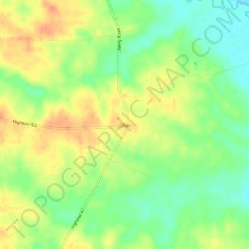
Name: Felps topographic map, elevation, terrain.
Location: Felps, East Feliciana Parish, Louisiana, United States (30.95712 -90.93871 30.99712 -90.89871)
Average elevation: 81 m
Minimum elevation: 60 m
Maximum elevation: 101 m
Thank you for supporting this site ❤️
Make a donation
Make a donation
Other topographic maps
Click on a map to view its topography, its elevation and its terrain.