
Vara Superiore topographic map
Interactive map
Click on the map to display elevation.
About this map
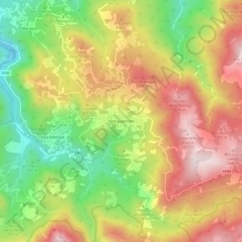
Name: Vara Superiore topographic map, elevation, terrain.
Location: Vara Superiore, Urbe, Savona, Ligurien, 17048, Italien (44.44871 8.60427 44.48871 8.64427)
Average elevation: 819 m
Minimum elevation: 555 m
Maximum elevation: 1,070 m