
Thank you for supporting this site ❤️
Make a donation
Make a donation
San Esteban topographic map
Click on the map to display elevation.
Thank you for supporting this site ❤️
Make a donation
Make a donation
About this map
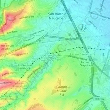
Name: San Esteban topographic map, elevation, terrain.
Average elevation: 2,297 m
Minimum elevation: 2,257 m
Maximum elevation: 2,378 m
Thank you for supporting this site ❤️
Make a donation
Make a donation
Other topographic maps
Click on a map to view its topography, its elevation and its terrain.
San Lorenzo Totolinga 2a sección
México > Estado de México > Naucalpan de Juárez > San Lorenzo Totolinga
Average elevation: 2,387 m
San Bartolo Naucalpan Centro
México > Estado de México > Naucalpan de Juárez
Average elevation: 2,280 m
Río Naucalpan-Huixquilucan
México > Estado de México > Naucalpan de Juárez > Benito Juárez
Average elevation: 2,369 m
Thank you for supporting this site ❤️
Make a donation
Make a donation