
Thank you for supporting this site ❤️
Make a donation
Make a donation
Glenprosen Lodge topographic map
Click on the map to display elevation.
Thank you for supporting this site ❤️
Make a donation
Make a donation
About this map
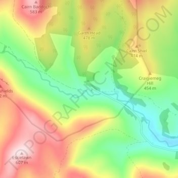
Name: Glenprosen Lodge topographic map, elevation, terrain.
Location: Glenprosen Lodge, Angus, Scotland, DD8 4SD, United Kingdom (56.77808 -3.18308 56.81808 -3.14308)
Average elevation: 411 m
Minimum elevation: 250 m
Maximum elevation: 606 m
Thank you for supporting this site ❤️
Make a donation
Make a donation
Other topographic maps
Click on a map to view its topography, its elevation and its terrain.
Thank you for supporting this site ❤️
Make a donation
Make a donation
Thank you for supporting this site ❤️
Make a donation
Make a donation
Thank you for supporting this site ❤️
Make a donation
Make a donation