
Thank you for supporting this site ❤️
Make a donation
Make a donation
Gifford topographic map
Click on the map to display elevation.
Thank you for supporting this site ❤️
Make a donation
Make a donation
About this map
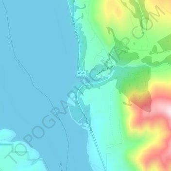
Name: Gifford topographic map, elevation, terrain.
Location: Gifford, Stevens County, Washington, 99131, United States (48.28628 -118.16638 48.32628 -118.12638)
Average elevation: 503 m
Minimum elevation: 384 m
Maximum elevation: 993 m
Thank you for supporting this site ❤️
Make a donation
Make a donation
Other topographic maps
Click on a map to view its topography, its elevation and its terrain.
Thank you for supporting this site ❤️
Make a donation
Make a donation
Thank you for supporting this site ❤️
Make a donation
Make a donation
Thank you for supporting this site ❤️
Make a donation
Make a donation