
Thank you for supporting this site ❤️
Make a donation
Make a donation
Mount Scarlett topographic map
Click on the map to display elevation.
Thank you for supporting this site ❤️
Make a donation
Make a donation
About this map
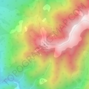
Name: Mount Scarlett topographic map, elevation, terrain.
Location: Mount Scarlett, Buller District, West Coast, New Zealand (-41.34409 172.26173 -41.34399 172.26183)
Average elevation: 802 m
Minimum elevation: 286 m
Maximum elevation: 1,296 m
Thank you for supporting this site ❤️
Make a donation
Make a donation
Other topographic maps
Click on a map to view its topography, its elevation and its terrain.