
Thank you for supporting this site ❤️
Make a donation
Make a donation
Cerro Mateo topographic map
Click on the map to display elevation.
Thank you for supporting this site ❤️
Make a donation
Make a donation
About this map
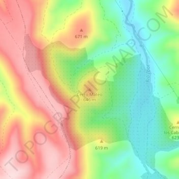
Name: Cerro Mateo topographic map, elevation, terrain.
Location: Cerro Mateo, Castañar de Ibor, Cáceres, Extremadura, España (39.64823 -5.46595 39.64833 -5.46585)
Average elevation: 586 m
Minimum elevation: 448 m
Maximum elevation: 731 m
Thank you for supporting this site ❤️
Make a donation
Make a donation
Other topographic maps
Click on a map to view its topography, its elevation and its terrain.