
Thank you for supporting this site ❤️
Make a donation
Make a donation
Hallsbergs kommun topographic map
Click on the map to display elevation.
Thank you for supporting this site ❤️
Make a donation
Make a donation
About this map
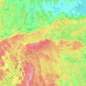
Name: Hallsbergs kommun topographic map, elevation, terrain.
Location: Hallsbergs kommun, Provinz Örebro, Schweden (58.80681 14.70539 59.17911 15.59404)
Average elevation: 92 m
Minimum elevation: 20 m
Maximum elevation: 226 m
Thank you for supporting this site ❤️
Make a donation
Make a donation
Other topographic maps
Click on a map to view its topography, its elevation and its terrain.