
Mazar-e-Charif topographic map
Interactive map
Click on the map to display elevation.
About this map
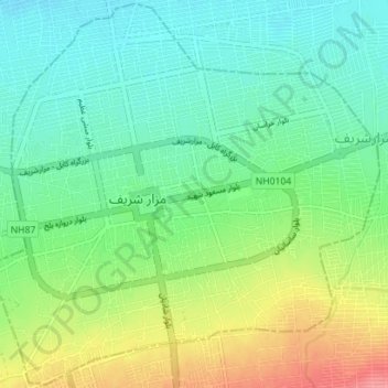
Name: Mazar-e-Charif topographic map, elevation, terrain.
Location: Mazar-e-Charif, Balkh, 1701, Afghanistan (36.68282 67.08289 36.73822 67.15313)
Average elevation: 367 m
Minimum elevation: 342 m
Maximum elevation: 416 m
Other topographic maps
Click on a map to view its topography, its elevation and its terrain.
Mazar-e-Charif
Afghanistan > Balkh > Mazar-e-Charif
Mazar-e-Charif, مزار شریف, Balkh, 1701, Afghanistan
Average elevation: 487 m