
Übersbach topographic map
Interactive map
Click on the map to display elevation.
About this map
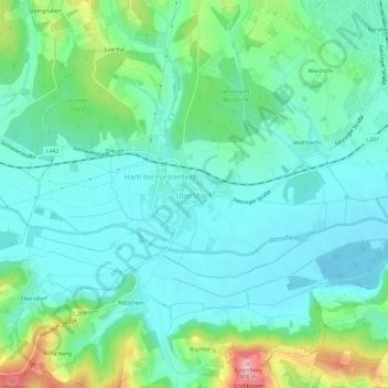
Name: Übersbach topographic map, elevation, terrain.
Location: Übersbach, Hartberg-Fürstenfeld, Steiermark, 8280, Österreich (47.00406 16.03529 47.04406 16.07529)
Average elevation: 283 m
Minimum elevation: 244 m
Maximum elevation: 406 m