
Thank you for supporting this site ❤️
Make a donation
Make a donation
Bowler topographic map
Click on the map to display elevation.
Thank you for supporting this site ❤️
Make a donation
Make a donation
About this map
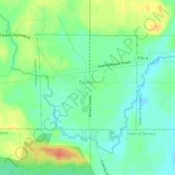
Name: Bowler topographic map, elevation, terrain.
Location: Bowler, Shawano County, Wisconsin, United States (44.85400 -88.99360 44.87038 -88.97130)
Average elevation: 331 m
Minimum elevation: 314 m
Maximum elevation: 360 m
Thank you for supporting this site ❤️
Make a donation
Make a donation
Other topographic maps
Click on a map to view its topography, its elevation and its terrain.