
Thank you for supporting this site ❤️
Make a donation
Make a donation
Buchberg topographic map
Click on the map to display elevation.
Thank you for supporting this site ❤️
Make a donation
Make a donation
About this map
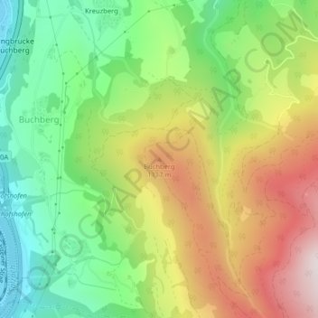
Name: Buchberg topographic map, elevation, terrain.
Location: Buchberg, Salzburg, 5500, Österreich (47.40821 13.24421 47.40831 13.24431)
Average elevation: 893 m
Minimum elevation: 539 m
Maximum elevation: 1,368 m
Thank you for supporting this site ❤️
Make a donation
Make a donation