
Thank you for supporting this site ❤️
Make a donation
Make a donation
Gajner topographic map
Click on the map to display elevation.
Thank you for supporting this site ❤️
Make a donation
Make a donation
About this map
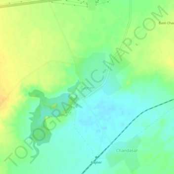
Name: Gajner topographic map, elevation, terrain.
Location: Gajner, Kolayat Tehsil, Bikaner, Rajasthan, 334300, India (27.93190 73.03904 27.97190 73.07904)
Average elevation: 223 m
Minimum elevation: 211 m
Maximum elevation: 237 m
Thank you for supporting this site ❤️
Make a donation
Make a donation
Other topographic maps
Click on a map to view its topography, its elevation and its terrain.