
Thank you for supporting this site ❤️
Make a donation
Make a donation
Lalsot topographic map
Click on the map to display elevation.
Thank you for supporting this site ❤️
Make a donation
Make a donation
Lalsot
Lalsot is located at 26°34′N 76°20′E / 26.57°N 76.33°E / 26.57; 76.33. It has an average elevation of 298 metres (978 ft).
Thank you for supporting this site ❤️
Make a donation
Make a donation
About this map
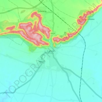
Name: Lalsot topographic map, elevation, terrain.
Location: Lalsot, Lalsot Tehsil, Dausa, Rajasthan, 303503, India (26.52307 76.28813 26.60307 76.36813)
Average elevation: 329 m
Minimum elevation: 278 m
Maximum elevation: 503 m
Thank you for supporting this site ❤️
Make a donation
Make a donation