
Thank you for supporting this site ❤️
Make a donation
Make a donation
Boykin topographic map
Click on the map to display elevation.
Thank you for supporting this site ❤️
Make a donation
Make a donation
About this map
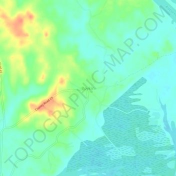
Name: Boykin topographic map, elevation, terrain.
Location: Boykin, Wilcox County, Alabama, 36723, United States (32.05792 -87.30138 32.09792 -87.26138)
Average elevation: 35 m
Minimum elevation: 21 m
Maximum elevation: 68 m
Thank you for supporting this site ❤️
Make a donation
Make a donation
Other topographic maps
Click on a map to view its topography, its elevation and its terrain.