
Make a donation
Tortula Cove topographic map
Click on the map to display elevation.
Make a donation
About this map
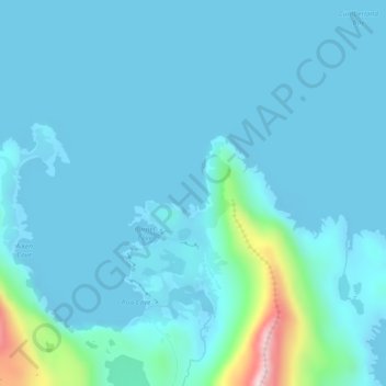
Name: Tortula Cove topographic map, elevation, terrain.
Average elevation: 40 m
Minimum elevation: -5 m
Maximum elevation: 406 m
Make a donation
Other topographic maps
Click on a map to view its topography, its elevation and its terrain.
South Georgia
South Georgia and the South Sandwich Islands > South Georgia
The island's topography includes a stepped sequence of flat surfaces interpreted as wave-cut platforms formed when sea level was higher relative to the island. At sea level strandflats have been described.
Average elevation: 87 m
Make a donation
Murray Snowfield
South Georgia and the South Sandwich Islands > South Georgia
Average elevation: 440 m
South Georgia
South Georgia and the South Sandwich Islands > South Georgia
The island's topography includes a stepped sequence of flat surfaces interpreted as wave-cut platforms formed when sea level was higher relative to the island. At sea level strandflats have been described.
Average elevation: 87 m
Make a donation