
Thank you for supporting this site ❤️
Make a donation
Make a donation
Ludrio topographic map
Click on the map to display elevation.
Thank you for supporting this site ❤️
Make a donation
Make a donation
About this map
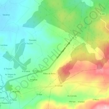
Name: Ludrio topographic map, elevation, terrain.
Location: Ludrio, Castro de Rei, Tierra Chá, Lugo, Galicia, España (43.10923 -7.45455 43.13872 -7.40277)
Average elevation: 475 m
Minimum elevation: 409 m
Maximum elevation: 585 m
Thank you for supporting this site ❤️
Make a donation
Make a donation
Other topographic maps
Click on a map to view its topography, its elevation and its terrain.