
Thank you for supporting this site ❤️
Make a donation
Make a donation
Maruia topographic map
Click on the map to display elevation.
Thank you for supporting this site ❤️
Make a donation
Make a donation
About this map
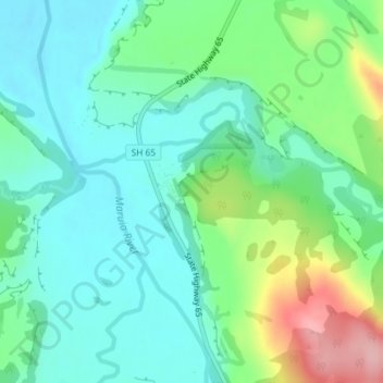
Name: Maruia topographic map, elevation, terrain.
Location: Maruia, Buller District, West Coast, 7062, New Zealand (-42.19901 172.21374 -42.17901 172.23374)
Average elevation: 374 m
Minimum elevation: 329 m
Maximum elevation: 494 m
Thank you for supporting this site ❤️
Make a donation
Make a donation
Other topographic maps
Click on a map to view its topography, its elevation and its terrain.