
Thank you for supporting this site ❤️
Make a donation
Make a donation
The Head topographic map
Click on the map to display elevation.
Thank you for supporting this site ❤️
Make a donation
Make a donation
About this map
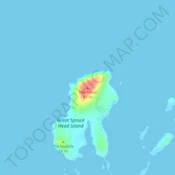
Name: The Head topographic map, elevation, terrain.
Location: The Head, Deer Isle, Hancock County, Maine, United States (44.24003 -68.82341 44.24013 -68.82331)
Average elevation: 2 m
Minimum elevation: -4 m
Maximum elevation: 62 m
Thank you for supporting this site ❤️
Make a donation
Make a donation