
Thank you for supporting this site ❤️
Make a donation
Make a donation
Heerenveen topographic map
Click on the map to display elevation.
Thank you for supporting this site ❤️
Make a donation
Make a donation
About this map
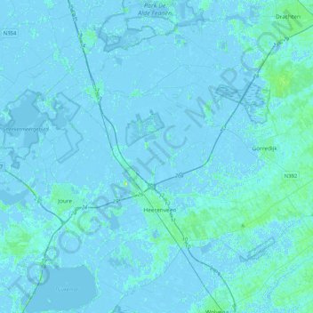
Name: Heerenveen topographic map, elevation, terrain.
Location: Heerenveen, Frisia, Netherlands (52.91174 5.79551 53.08521 6.20542)
Average elevation: 0 m
Minimum elevation: -5 m
Maximum elevation: 11 m
Thank you for supporting this site ❤️
Make a donation
Make a donation
Other topographic maps
Click on a map to view its topography, its elevation and its terrain.