
Aydın topographic map
Interactive map
Click on the map to display elevation.
About this map
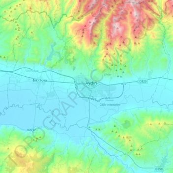
Name: Aydın topographic map, elevation, terrain.
Location: Aydın, Efeler, Aydın, Ägäisregion, 09020, Türkei (37.68130 27.67284 38.00130 27.99284)
Average elevation: 348 m
Minimum elevation: 17 m
Maximum elevation: 1,688 m