
Thank you for supporting this site ❤️
Make a donation
Make a donation
Livona topographic map
Click on the map to display elevation.
Thank you for supporting this site ❤️
Make a donation
Make a donation
About this map
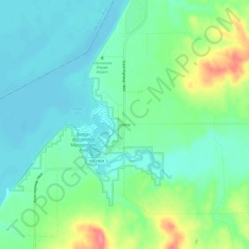
Name: Livona topographic map, elevation, terrain.
Location: Livona, Emmons County, North Dakota, United States (46.48222 -100.56706 46.52222 -100.52706)
Average elevation: 508 m
Minimum elevation: 486 m
Maximum elevation: 562 m
Thank you for supporting this site ❤️
Make a donation
Make a donation
Other topographic maps
Click on a map to view its topography, its elevation and its terrain.