
Kalkankale topographic map
Interactive map
Click on the map to display elevation.
About this map
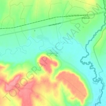
Name: Kalkankale topographic map, elevation, terrain.
Location: Kalkankale, Akyaka, Kars, Eastern Anatolia Region, Turkey (40.69545 43.70161 40.73545 43.74161)
Average elevation: 1,486 m
Minimum elevation: 1,446 m
Maximum elevation: 1,546 m