
Château de Rastignac topographic map
Interactive map
Click on the map to display elevation.
About this map
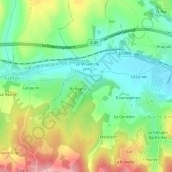
Name: Château de Rastignac topographic map, elevation, terrain.
Average elevation: 172 m
Minimum elevation: 111 m
Maximum elevation: 268 m
Other topographic maps
Click on a map to view its topography, its elevation and its terrain.
Les Rocs
France > Nouvelle-Aquitaine > La Bachellerie > Les Rocs
Les Rocs, La Bachellerie, Sarlat-la-Canéda, Dordogne, Nouvelle-Aquitaine, France métropolitaine, 24210, France
Average elevation: 179 m