
Thank you for supporting this site ❤️
Make a donation
Make a donation
Villers-en-Fagne topographic map
Click on the map to display elevation.
Thank you for supporting this site ❤️
Make a donation
Make a donation
About this map
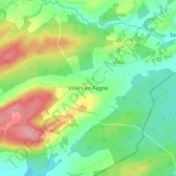
Name: Villers-en-Fagne topographic map, elevation, terrain.
Location: Villers-en-Fagne, Philippeville, Namur, Wallonia, 5600, Belgium (50.12579 4.56462 50.16579 4.60462)
Average elevation: 205 m
Minimum elevation: 165 m
Maximum elevation: 273 m
Thank you for supporting this site ❤️
Make a donation
Make a donation
Other topographic maps
Click on a map to view its topography, its elevation and its terrain.