
Thank you for supporting this site ❤️
Make a donation
Make a donation
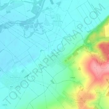
Sušice topographic map
Click on the map to display elevation.
Thank you for supporting this site ❤️
Make a donation
Make a donation
Sušice
Sušice befindet sich linksseitig der Bečva zwischen deren Zuflüssen Libuška und Libuše in der Mährischen Pforte. Das Dorf liegt am Fuße des zur Podbeskydská pahorkatina (Vorbeskidenhügelland) gehörigen Höhenzuges Záhoří. Östlich erhebt sich der Přísahanec (333 m).
Thank you for supporting this site ❤️
Make a donation
Make a donation
About this map
Name: Sušice topographic map, elevation, terrain.
Average elevation: 242 m
Minimum elevation: 214 m
Maximum elevation: 334 m
Thank you for supporting this site ❤️
Make a donation
Make a donation
Other topographic maps
Click on a map to view its topography, its elevation and its terrain.