
Niederland topographic map
Interactive map
Click on the map to display elevation.
About this map
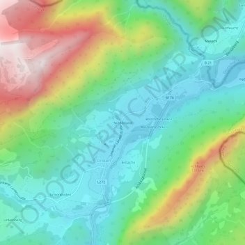
Name: Niederland topographic map, elevation, terrain.
Location: Niederland, Unken, Bezirk Zell am See, Salzburg, 5091, Austria (47.63725 12.71494 47.67725 12.75494)
Average elevation: 843 m
Minimum elevation: 519 m
Maximum elevation: 1,548 m