
Thank you for supporting this site ❤️
Make a donation
Make a donation
Cortland topographic map
Click on the map to display elevation.
Thank you for supporting this site ❤️
Make a donation
Make a donation
About this map
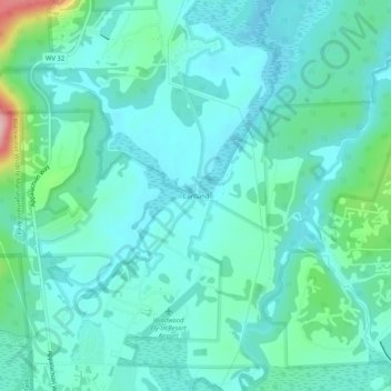
Name: Cortland topographic map, elevation, terrain.
Location: Cortland, Tucker County, West Virginia, 26260, United States (39.04705 -79.44755 39.08705 -79.40755)
Average elevation: 990 m
Minimum elevation: 954 m
Maximum elevation: 1,154 m
Thank you for supporting this site ❤️
Make a donation
Make a donation
Other topographic maps
Click on a map to view its topography, its elevation and its terrain.
Canaan Valley Resort State Park
United States > West Virginia > Tucker County
Average elevation: 1,033 m
Thank you for supporting this site ❤️
Make a donation
Make a donation