
Garciaz topographic map
Interactive map
Click on the map to display elevation.
About this map
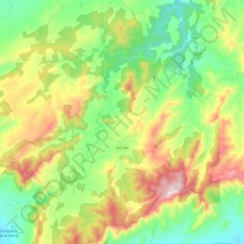
Name: Garciaz topographic map, elevation, terrain.
Location: Garciaz, Trujillo, Cáceres, Estremadura, Espanha (39.34314 -5.71816 39.51975 -5.53315)
Average elevation: 679 m
Minimum elevation: 420 m
Maximum elevation: 1,126 m