
Thank you for supporting this site ❤️
Make a donation
Make a donation
Arangala topographic map
Click on the map to display elevation.
Thank you for supporting this site ❤️
Make a donation
Make a donation
About this map
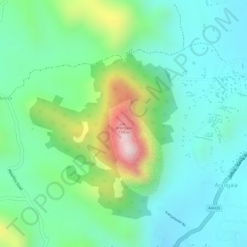
Name: Arangala topographic map, elevation, terrain.
Location: Arangala, Naula, Matale District, Central Province, Sri Lanka (7.69808 80.63848 7.69818 80.63858)
Average elevation: 411 m
Minimum elevation: 276 m
Maximum elevation: 737 m
Thank you for supporting this site ❤️
Make a donation
Make a donation