
Huaikou topographic map
Interactive map
Click on the map to display elevation.
About this map
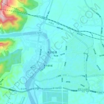
Name: Huaikou topographic map, elevation, terrain.
Location: Huaikou, Chengdu City, Sichuan, China (30.67740 104.51643 30.75740 104.59643)
Average elevation: 470 m
Minimum elevation: 419 m
Maximum elevation: 834 m