
Thank you for supporting this site ❤️
Make a donation
Make a donation
Muttil topographic map
Click on the map to display elevation.
Thank you for supporting this site ❤️
Make a donation
Make a donation
About this map
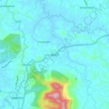
Name: Muttil topographic map, elevation, terrain.
Location: Muttil, Vythiri, Wayanad, Kerala, 673122, India (11.60184 76.07062 11.68184 76.15062)
Average elevation: 785 m
Minimum elevation: 722 m
Maximum elevation: 1,289 m
Thank you for supporting this site ❤️
Make a donation
Make a donation
Other topographic maps
Click on a map to view its topography, its elevation and its terrain.