
Thank you for supporting this site ❤️
Make a donation
Make a donation
Phluang Song Nang topographic map
Click on the map to display elevation.
Thank you for supporting this site ❤️
Make a donation
Make a donation
About this map
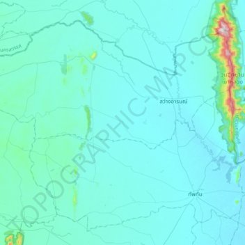
Name: Phluang Song Nang topographic map, elevation, terrain.
Location: Phluang Song Nang, Sawang Arom, Uthai Thani Province, Thailand (15.39480 99.63240 15.71480 99.95240)
Average elevation: 76 m
Minimum elevation: 27 m
Maximum elevation: 763 m
Thank you for supporting this site ❤️
Make a donation
Make a donation