
Elappara topographic map
Click on the map to display elevation.
Elappara
Elappara is a village in Idukki district in the Indian state of Kerala. It is one of the panchayaths in Peerumedu taluk. The area is marked by a cool climate as the region is situated at an elevation of more than 1,000 m (3,300 ft) above the sea level. Elappara is famous for its vast tea plantations.
About this map
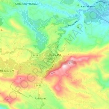
Name: Elappara topographic map, elevation, terrain.
Location: Elappara, Idukki, Kerala, 685501, India (9.59062 76.93847 9.67062 77.01847)
Average elevation: 1,049 m
Minimum elevation: 762 m
Maximum elevation: 1,508 m
Other topographic maps
Click on a map to view its topography, its elevation and its terrain.