
Thank you for supporting this site ❤️
Make a donation
Make a donation
Ghasi topographic map
Click on the map to display elevation.
Thank you for supporting this site ❤️
Make a donation
Make a donation
About this map
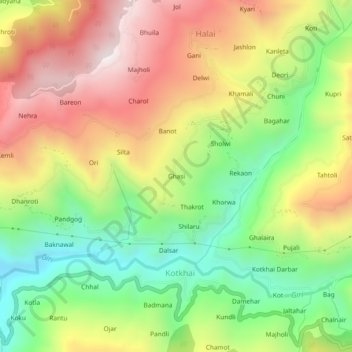
Name: Ghasi topographic map, elevation, terrain.
Location: Ghasi, Kotkhai, Shimla, Himachal Pradesh, 171202, India (31.10904 77.52014 31.14904 77.56014)
Average elevation: 1,974 m
Minimum elevation: 1,528 m
Maximum elevation: 2,474 m
Thank you for supporting this site ❤️
Make a donation
Make a donation