
Thank you for supporting this site ❤️
Make a donation
Make a donation
Warne topographic map
Click on the map to display elevation.
Thank you for supporting this site ❤️
Make a donation
Make a donation
About this map
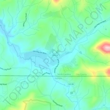
Name: Warne topographic map, elevation, terrain.
Location: Warne, Clay County, North Carolina, 28909, United States (34.97485 -83.91299 35.01485 -83.87299)
Average elevation: 568 m
Minimum elevation: 510 m
Maximum elevation: 756 m
Thank you for supporting this site ❤️
Make a donation
Make a donation
Other topographic maps
Click on a map to view its topography, its elevation and its terrain.