
Thank you for supporting this site ❤️
Make a donation
Make a donation
Seehaus topographic map
Click on the map to display elevation.
Thank you for supporting this site ❤️
Make a donation
Make a donation
About this map
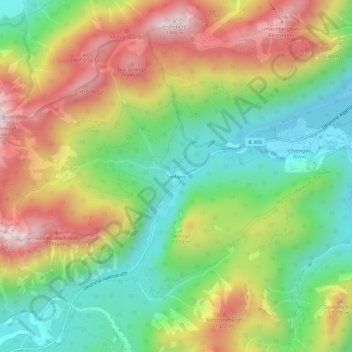
Name: Seehaus topographic map, elevation, terrain.
Location: Seehaus, Ruhpolding, Landkreis Traunstein, Bayern, Deutschland (47.69114 12.60154 47.73114 12.64154)
Average elevation: 1,028 m
Minimum elevation: 698 m
Maximum elevation: 1,468 m
Thank you for supporting this site ❤️
Make a donation
Make a donation
Other topographic maps
Click on a map to view its topography, its elevation and its terrain.