
Nagaa Al Mahata topographic map
Interactive map
Click on the map to display elevation.
About this map
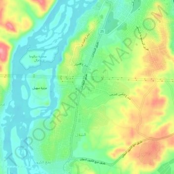
Name: Nagaa Al Mahata topographic map, elevation, terrain.
Location: Nagaa Al Mahata, Aswan, 81531, Egypt (24.03998 32.86605 24.08357 32.90425)
Average elevation: 122 m
Minimum elevation: 81 m
Maximum elevation: 193 m
Other topographic maps
Click on a map to view its topography, its elevation and its terrain.