
Thank you for supporting this site ❤️
Make a donation
Make a donation
Skaftafell topographic map
Click on the map to display elevation.
Thank you for supporting this site ❤️
Make a donation
Make a donation
About this map
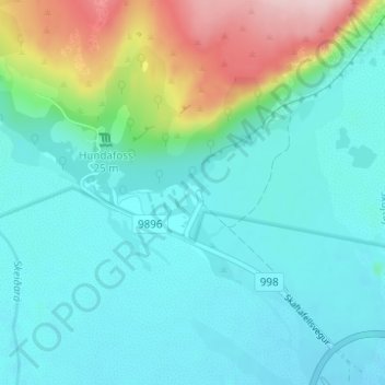
Name: Skaftafell topographic map, elevation, terrain.
Average elevation: 131 m
Minimum elevation: 77 m
Maximum elevation: 322 m
Thank you for supporting this site ❤️
Make a donation
Make a donation
Other topographic maps
Click on a map to view its topography, its elevation and its terrain.
Öræfajökull
Iceland > Sveitarfélagið Hornafjörður
The summit caldera of this stratovolcano is 3 km × 4 km (1.9 mi × 2.5 mi) and the volcano is 20 km (12 mi) in diameter. It is the most southern of the volcanoes in the Öræfi volcanic belt (Öræfajökull volcanic belt), which is possibly an embryonic rift parallel and to the east of the Eastern volcanic…
Average elevation: 744 m
Thank you for supporting this site ❤️
Make a donation
Make a donation