
Puttaparthi topographic map
Interactive map
Click on the map to display elevation.
About this map
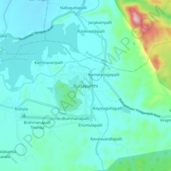
Name: Puttaparthi topographic map, elevation, terrain.
Location: Puttaparthi, Anantapur, Andhra Pradesh, 515134, India (14.12368 77.77250 14.20368 77.85250)
Average elevation: 501 m
Minimum elevation: 424 m
Maximum elevation: 923 m