
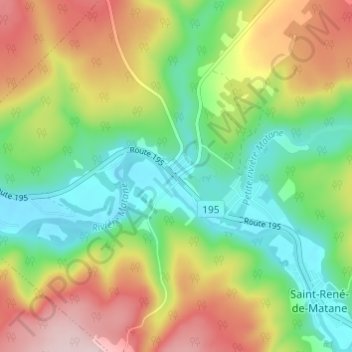
Ruisseau-Gagnon topographic map
Interactive map
Click on the map to display elevation.
About this map
Name: Ruisseau-Gagnon topographic map, elevation, terrain.
Average elevation: 153 m
Minimum elevation: 36 m
Maximum elevation: 324 m
Other topographic maps
Click on a map to view its topography, its elevation and its terrain.
Le Renversé
Canada > Québec > La Matanie > Saint-René-de-Matane > Le Renversé
Le Renversé, Saint-René-de-Matane, La Matanie, Bas-Saint-Laurent, Québec, G0J 3E0, Canada
Average elevation: 270 m