
Ekoum topographic map
Interactive map
Click on the map to display elevation.
About this map
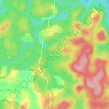
Name: Ekoum topographic map, elevation, terrain.
Location: Ekoum, Bot-Makak, Nyong-et-Kéllé, Région du Centre, Cameroun (3.95644 11.15194 3.99644 11.19194)
Average elevation: 642 m
Minimum elevation: 563 m
Maximum elevation: 727 m
Other topographic maps
Click on a map to view its topography, its elevation and its terrain.
Lelep
Cameroun > Région du Centre > Nyong-et-Kéllé > Bot-Makak
Lelep, Bot-Makak, Nyong-et-Kéllé, Région du Centre, Cameroun
Average elevation: 590 m