
GTC topographic map
Interactive map
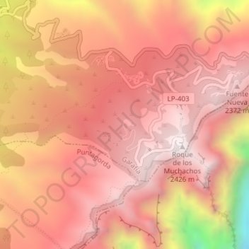
Click on the map to display elevation.
About this map
Name: GTC topographic map, elevation, terrain.
Average elevation: 2,122 m
Minimum elevation: 1,340 m
Maximum elevation: 2,424 m
Other topographic maps
Click on a map to view its topography, its elevation and its terrain.
Roque de los Muchachos
Roque de los Muchachos, Garafía, Santa Cruz de Tenerife, Canarias, España
Average elevation: 2,022 m