
Thank you for supporting this site ❤️
Make a donation
Make a donation
Heimariheyggjur topographic map
Click on the map to display elevation.
Thank you for supporting this site ❤️
Make a donation
Make a donation
About this map
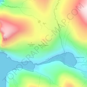
Name: Heimariheyggjur topographic map, elevation, terrain.
Location: Heimariheyggjur, Saksun, Streymoyar sýsla, 436, Færøerne (62.25304 -7.20537 62.25314 -7.20527)
Average elevation: 261 m
Minimum elevation: -2 m
Maximum elevation: 661 m
Thank you for supporting this site ❤️
Make a donation
Make a donation