
Richmondshire topographic map
Interactive map
Click on the map to display elevation.
About this map
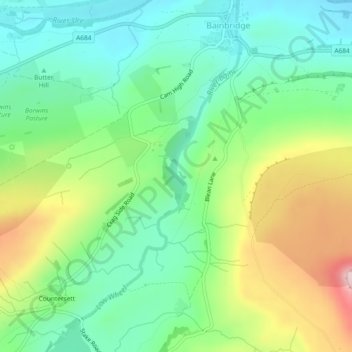
Name: Richmondshire topographic map, elevation, terrain.
Average elevation: 294 m
Minimum elevation: 200 m
Maximum elevation: 475 m
Other topographic maps
Click on a map to view its topography, its elevation and its terrain.
Middleham
Royaume-Uni > Angleterre > Richmondshire > Middleham
Middleham, Richmondshire, North Yorkshire, Yorkshire and the Humber, Angleterre, DL8 4PJ, Royaume-Uni
Average elevation: 190 m
Richmondshire
Royaume-Uni > Angleterre > Richmondshire
Richmondshire, North Yorkshire, Yorkshire and the Humber, Angleterre, Royaume-Uni
Average elevation: 301 m
High Abbotside
Royaume-Uni > Angleterre > Richmondshire
High Abbotside, Richmondshire, North Yorkshire, Yorkshire and the Humber, Angleterre, Royaume-Uni
Average elevation: 446 m